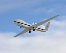
The Riegl Uncrewed Aerial Vehicle (UAV) Lidar Sensors are lidar systems from Riegl Laser Measurement Systems, designed for use on UAVs. These sensors are more compact and lightweight than Riegl's airborne lidar systems. They are commonly used for topographic mapping in remote areas for agricultural, forestry, and geological applications. They can have a field of view of up to 360 degrees, scan speeds of up to 200 scans per second, and an accuracy of 10 mm.

Instrument Details
- Lidar
- Earth Science > Spectral/engineering > Lidar > Lidar BackscatterEarth Science > Spectral/engineering > LidarEarth Science > Land Surface > Topography
- Land Surface
- Variable
- Variable
- Variable
- Currently unavailable
Currently unavailable
Currently unavailable
Riegl
Currently unavailable
Currently unavailable
Unpublished
 Uncrewed Aerial Vehicle 5 Campaigns · 6 Instruments |  SnowEx 2016—2023 Colorado, Idaho, Utah, Alaska 4 Deployments · 86 Data Products
|
Filter data products from this instrument by specific campaigns, platforms, or formats.
CAMPAIGNS
PLATFORMS
FORMATS